FREE GIS Data Mapping For Water, Waste, and Energy Projects
GeoCATA was built to support environmental, regulatory, and engineering projects.
Included as standard on active projects, the database is one of the most comprehensive and cost-effective spatial databases, designed to give your essential resources access to the project data they need without database or GIS expertise.
GeoCATA Features
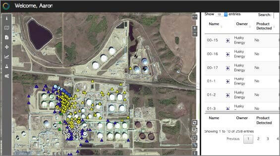
GeoCATA offers users over 500 filterable data layers on a simple, feature-rich, user interface to make navigating complex data easier.
Our spatial data is constantly updated, providing users with the most relevant information available to make decisions. Additional data is added to the system to allow for changing business priorities, such as the recent addition of Environmental, Social and Governance (ESG) data sets in February.
Features & Capabilities
- Imagery, including PPK Capable
- Multispectral Imagery
- Web application (nothing to install)
- Dynamic filtering and data export
- Workspace creation and sharing
- Feature creation, editing and sharing
- Horizontal profiling
- Multiple annotation layers
- Interlinked datasets such as Water Licenses and Water Use Reporting (WURs)
Business & Regulatory Data
- Well Production
- Well Injection Data
- Water Usage Movements
- Water Act Licenses
- Water Use Reporting (WURS) Data
- Hydraulic Fracturing Details
- Mineral Lease Data
Environmental Data
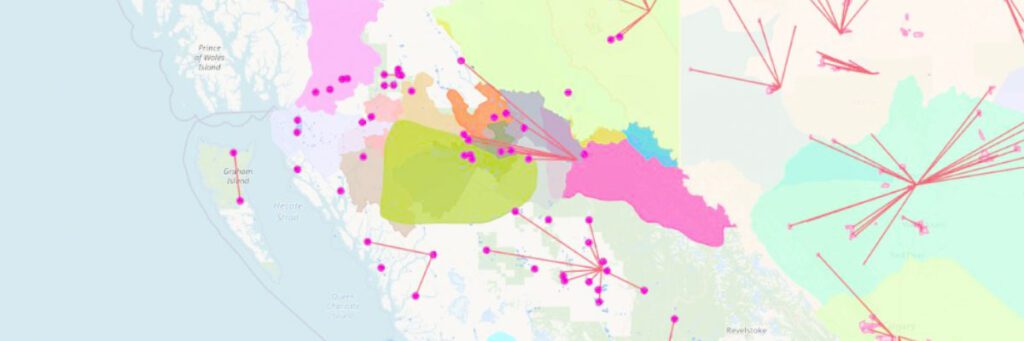
- Vegetation
- Hydrology
- Groundwater
- Climate
- Wildlife
- Geology
- Topography
Administrative Data
- Transportation
- Cadastral
- Surface Dispositions
- First Nations Administrative Areas
- Regional Coal Agreement Areas
- Tribal Councils
- First Nations Tribal Relationship

IoT Connectivity
More so than ever, effective data collection and visualization are recognized by industry leaders as a critical component in natural resource management. When monitoring distant locations, we recognized the need to reduce costly in-field assessments and increase data collection frequency to better understand variability and statistical errors.
GeoCATA is best paired with IoT-connected devices to enhance your reporting capabilities. Bring your (or third-party) data streams directly to your database and monitor your infrastructure to better understand your market and identify business opportunities.
- Understand your client’s activity in an area of interest
- Identify historical water withdrawal locations and volumes
- Access your client’s water licenses (active and past)
- Support your temporary field authorization submissions

Management and Reporting
To support you with our technology-enabled workflows, we also provide systems integration, installation assistance, and a variety of remote telemetry options to improve onsite visibility.
Our customizable monitoring and siting packages are supported by data visualization and reporting software that helps you pinpoint infrastructure performance and further de-risk your project.
- ESG materiality assessments & benchmarking
- Climate change consulting
- ESG reporting & compliance
- Insurance, financing, and carbon credits
- Social inclusivity studies
- Opportunities in the energy transition
- Corporate governance advisory