Project Lifecycle Insights
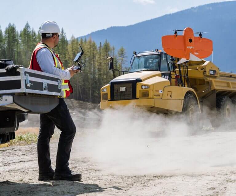
Over the last 15 years, drone and remote scanning have become invaluable tools to collect large amounts of project data. However, this data can sometimes be overwhelming in scope, with little insight gained.
Working with industry leaders to connect remote sensors, and automate drone and scan data processing, we integrate with data visualization tools to generate actionable insights across the project lifecycle: from siting and design, right through to regulatory permitting applications and commissioning.

A Digital Twin For Your Infrastructure
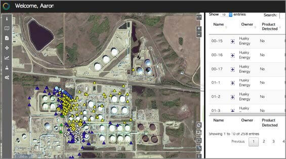
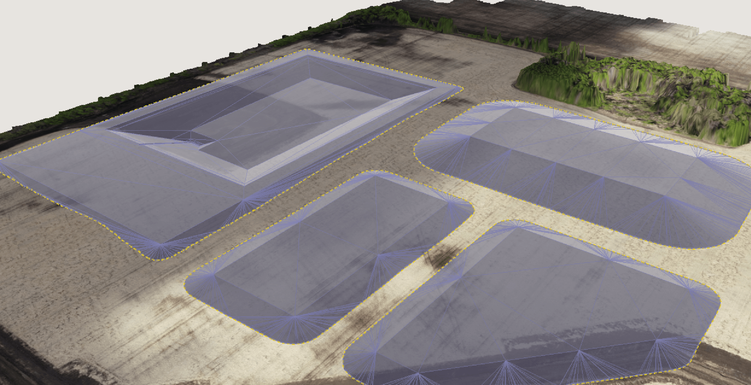
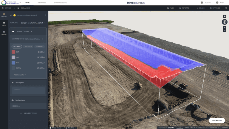
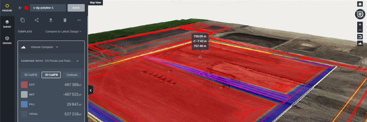
Orthography is the cloud-based processing method by which we generate a 3d, on-demand, spatial map of your project, with actionable data points detailing performance. Used effectively, this tool can help keep budgets lean by identifying the potential site, design, and/or implementation challenges, with minimal onsite staff.
Post-project completion, we also collect data from remote in-situ sensors to give you a concise dashboard of your operational environment. This functionality is helping customers submit automatic inspection reports for regulatory permitting, track emissions data, and claim carbon credits.
Data Integration Services
- Water sensing telemetry
- Geographical Information System mapping
- LIDAR, multispectral imagery, and bathymetry mapping
- Orthophoto, point cloud, digital elevation models, 3D models
- Air quality monitoring
- Automatic regulatory permitting
- Engineering and Regulatory Siting Tools
- Inventory Management System
- Integrated Data Management System
- Data Analytics and Visualization Packages
- Regulatory Assessments & Evaluations
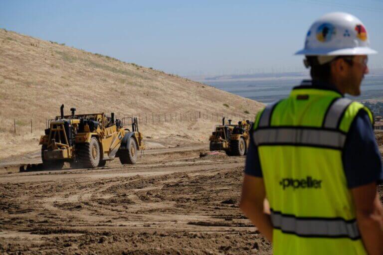
Optimize Construction
With your worksite properly mapped, both engineering and construction have access to the same data, improving transparency and communication.
During construction we use cloud-based processing to turn imagery into real time information and verify project sites daily, fit to design, daily productions, and site conditions. The data we share is then integrated with machine control and design files which can help visualize site conditions, verify fabricated components, determine tie in’s, and perform clash detection.
Quality assurance (QA) and quality control (QC) services are pre-requisite for any of our owner-engineer, EPC, or EPCM projects. Our project delivery system can be tailored to the risk and scale of each construction project, and we can also offer other delivery models alongside our traditional owner-engineer and EPCM services. Contact us to find out more.

Management and Reporting
To support you with our technology-enabled workflows, we also provide systems integration, installation assistance, and a variety of remote telemetry options to improve onsite visibility.
Our customizable monitoring and siting packages are supported by data visualization and reporting software that helps you pinpoint infrastructure performance and further de-risk your project.
- 24/7 cloud-based connectivity
- SMS & email alerts
- Self-service data dashboard
- Custom reporting
- Personnel training
- Monitoring program software
- Monitoring software installation & support
- Integrated Data Management System
- Data Analytics and Visualization Packages
- Engineering and Regulatory Siting Tools
- Regulatory Assessments & Evaluations